Friday, December 01, 2006

12.01.06 Work in Progress
Development of Form in Progress:
Sections
Transportation / Infrastructure Network
Repeating modules
Morphing caused by Water
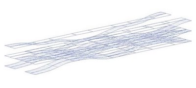




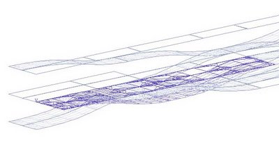
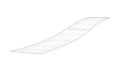
Sections
Transportation / Infrastructure Network
Repeating modules
Morphing caused by Water


Wednesday, November 29, 2006
11.29.06 Progress
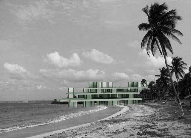
The first image begins to explore the juxtaposition of the linear form in 2 directions. It presents interesting opportunities for interaction with the land and water as well as unique conditions for the territory within the interior of the intersecting forms.

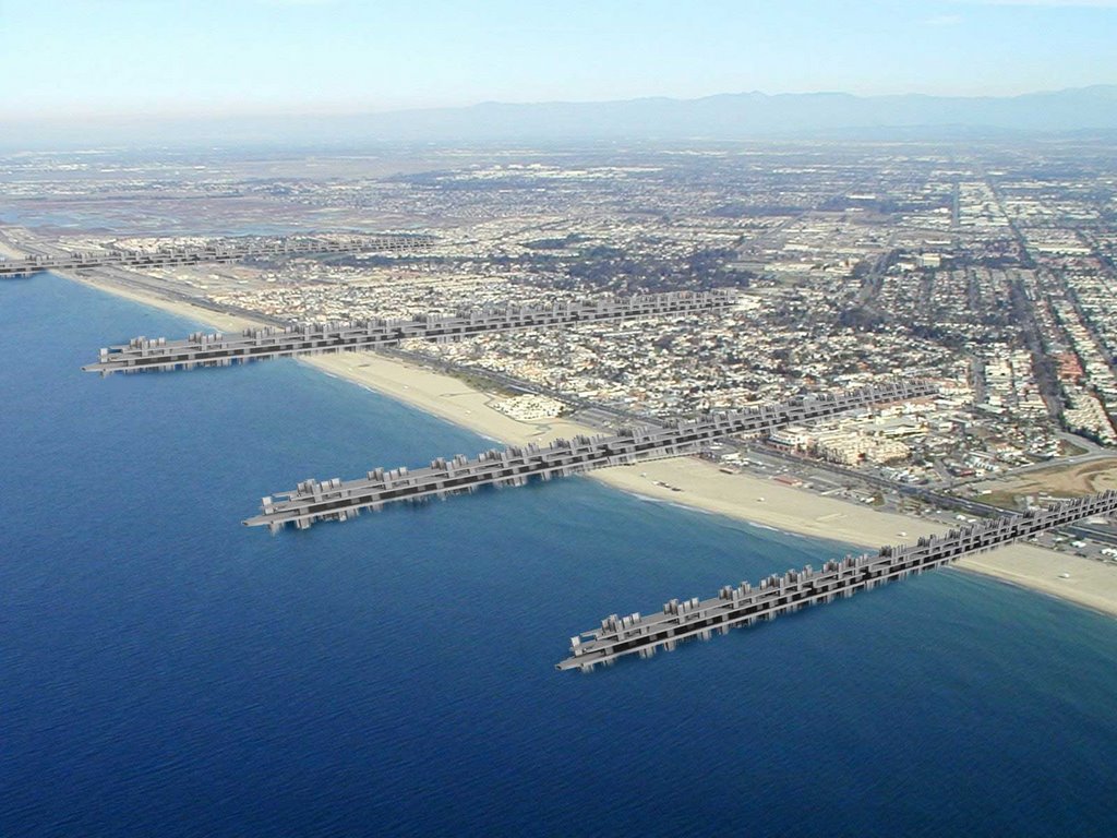
The second image takes a closer look at the linear forms: how they would house infrastructure as well as community life. Multiple levels would increase land area, particularly that which would otherwise be lost. The end of the form take on the shape of the contours from the land lost over time. Further exploration is needed to incorporate sunlight within the levels and see how the water interacts within the form as well as around it.


The second image takes a closer look at the linear forms: how they would house infrastructure as well as community life. Multiple levels would increase land area, particularly that which would otherwise be lost. The end of the form take on the shape of the contours from the land lost over time. Further exploration is needed to incorporate sunlight within the levels and see how the water interacts within the form as well as around it.

Tuesday, November 28, 2006



Sunday, November 26, 2006
11.26.06
The next step was to further define the idea of a wetland city and how it would be sited and developed programmatically based on previous research mappings.
SITE
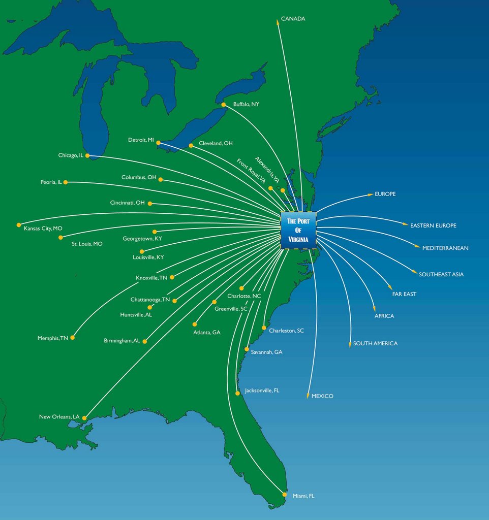
One of the prominent regions identified was the eastern coast of the United States. Upon further research into the areas most affected by global warming, the Chesapeake Bay region was near the top of the list. The rise in sea level is twice the world average and anticipated to rise 8 inches in the next 25 years. The area is one of the nation's top 5 ports with the Virginia Port Authority being the largest port complex in the United States. While it sits at a dangerously low elevation, the region around the port at Norfolk is thriving with business and links the country to international commerce. A port is a gateway to the economy within a country as well as one of the first regions affected by rising water. The image below shows the relationship of the Virginia ports to the rest of the world.
 The overall chosen site lies around the Norfolk area. The map below shows the Norfolk and Virginia Beach regions with the water and green space highlighted. The region exhibits characteristics of a wetland and the juxtaposition of two habitats.
PROGRAM
Replenish green space
Unharmed by flooding
Adaptable to warm climate / cools itself
Accessible by intrastructure
Partially inhabitable by water
Occupiable space to further tourism
Prevents erosion
he Norfolk area is center to finance, trade, tourism, shipbuilding, and food processing as well as an international port. In the event of flooding due to global warming, it will be important to maintain the infrastructure. The map below illustrates significant roads, ports, and train stations in orange.
 The purpose of this megastructure is to act as a MegaPort, operational in flood conditions by creating an environment similar to a wetland, but yet creating a flourishing economical center. The structure will be partially submerged with a significant portion constructed of shipping containers. Container cargo is expected to quadruple in the next 20 years to approximately 30 million containers per year.
The next step is to begin to define a form. At the moment, it will begin as a linear form running perpendicular to the main highway, yet connecting the main highway to the sea and port while partially submerged. The red area shows the targeted siting area.
SITE
One of the prominent regions identified was the eastern coast of the United States. Upon further research into the areas most affected by global warming, the Chesapeake Bay region was near the top of the list. The rise in sea level is twice the world average and anticipated to rise 8 inches in the next 25 years. The area is one of the nation's top 5 ports with the Virginia Port Authority being the largest port complex in the United States. While it sits at a dangerously low elevation, the region around the port at Norfolk is thriving with business and links the country to international commerce. A port is a gateway to the economy within a country as well as one of the first regions affected by rising water. The image below shows the relationship of the Virginia ports to the rest of the world.
 The overall chosen site lies around the Norfolk area. The map below shows the Norfolk and Virginia Beach regions with the water and green space highlighted. The region exhibits characteristics of a wetland and the juxtaposition of two habitats.
PROGRAM
Replenish green space
Unharmed by flooding
Adaptable to warm climate / cools itself
Accessible by intrastructure
Partially inhabitable by water
Occupiable space to further tourism
Prevents erosion
he Norfolk area is center to finance, trade, tourism, shipbuilding, and food processing as well as an international port. In the event of flooding due to global warming, it will be important to maintain the infrastructure. The map below illustrates significant roads, ports, and train stations in orange.
 The purpose of this megastructure is to act as a MegaPort, operational in flood conditions by creating an environment similar to a wetland, but yet creating a flourishing economical center. The structure will be partially submerged with a significant portion constructed of shipping containers. Container cargo is expected to quadruple in the next 20 years to approximately 30 million containers per year.
 The next step is to begin to define a form. At the moment, it will begin as a linear form running perpendicular to the main highway, yet connecting the main highway to the sea and port while partially submerged. The red area shows the targeted siting area.

Sunday, November 19, 2006
11.20.06
PROPOSAL
The Proposal considers the concept of a Wetland City. Designed as a hybrid between land and the sea, the city would accomodate flooding and be transformed by the new presence of water.
SITE
Although areas at risk to flooding due to global warming have been identified, the proposal could be set in a number of coastal cities or shores to other bodies of water. A site with a similar topography would be most favorable but with manmade on-site construction, the concept can be carried to almost any location.
The sketch below (My apologies for its distortion due to blogger) illustrates the land continues that dictate the need for a particular topography. A number of sketches and study were done to determine the best topography for flood control. The topography allows for the development of early wetlands and beginner flooding and accomodates the increase in water.
PROGRAM
High Density, Compact
Integrated Green space
Central Transportation & Communication Hub
Redefined yet maintained during flooding
Pedestrian friendly
 In the images, orange represents the transportation and yellow represents the housing and mixed use development.

HUMAN SCALE MODELS
PERSONAL THOUGHTS
I am experimentING with several advanced modeling tools but forsee the use of the cloning tool once the project is developed into more specific detail. Right now the use of FormZ is more hindering to the development of my project than it is aiding in the design. Full reliance on technology seems to strip away at the development process, and the continued frustrations kill the momentum of the design. I'm not designing for the project; I'm designing for FormZ. As far as the final critique, I would like to present with display boards to a group of reviewers. Blogger is not always reliable and inhibits our way of presenting.
The Proposal considers the concept of a Wetland City. Designed as a hybrid between land and the sea, the city would accomodate flooding and be transformed by the new presence of water.
SITE
Although areas at risk to flooding due to global warming have been identified, the proposal could be set in a number of coastal cities or shores to other bodies of water. A site with a similar topography would be most favorable but with manmade on-site construction, the concept can be carried to almost any location.
The sketch below (My apologies for its distortion due to blogger) illustrates the land continues that dictate the need for a particular topography. A number of sketches and study were done to determine the best topography for flood control. The topography allows for the development of early wetlands and beginner flooding and accomodates the increase in water.

PROGRAM
High Density, Compact
Integrated Green space
Central Transportation & Communication Hub
Redefined yet maintained during flooding
Pedestrian friendly
 In the images, orange represents the transportation and yellow represents the housing and mixed use development.
HUMAN SCALE MODELS
PERSONAL THOUGHTS
I am experimentING with several advanced modeling tools but forsee the use of the cloning tool once the project is developed into more specific detail. Right now the use of FormZ is more hindering to the development of my project than it is aiding in the design. Full reliance on technology seems to strip away at the development process, and the continued frustrations kill the momentum of the design. I'm not designing for the project; I'm designing for FormZ. As far as the final critique, I would like to present with display boards to a group of reviewers. Blogger is not always reliable and inhibits our way of presenting.
Wednesday, November 15, 2006


Subscribe to:
Posts (Atom)