SITE
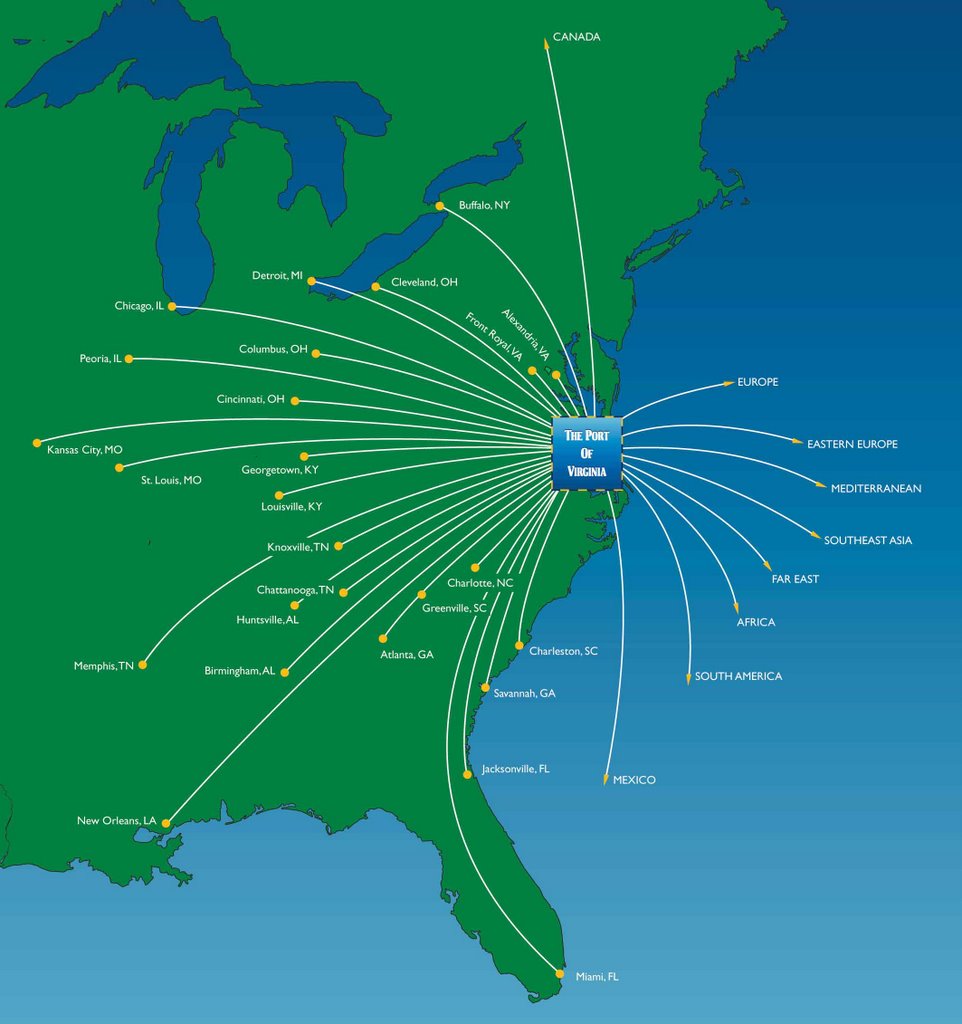
One of the prominent regions identified was the eastern coast of the United States. Upon further research into the areas most affected by global warming, the Chesapeake Bay region was near the top of the list. The rise in sea level is twice the world average and anticipated to rise 8 inches in the next 25 years. The area is one of the nation's top 5 ports with the Virginia Port Authority being the largest port complex in the United States. While it sits at a dangerously low elevation, the region around the port at Norfolk is thriving with business and links the country to international commerce. A port is a gateway to the economy within a country as well as one of the first regions affected by rising water. The image below shows the relationship of the Virginia ports to the rest of the world.
 The overall chosen site lies around the Norfolk area. The map below shows the Norfolk and Virginia Beach regions with the water and green space highlighted. The region exhibits characteristics of a wetland and the juxtaposition of two habitats.
PROGRAM
Replenish green space
Unharmed by flooding
Adaptable to warm climate / cools itself
Accessible by intrastructure
Partially inhabitable by water
Occupiable space to further tourism
Prevents erosion
he Norfolk area is center to finance, trade, tourism, shipbuilding, and food processing as well as an international port. In the event of flooding due to global warming, it will be important to maintain the infrastructure. The map below illustrates significant roads, ports, and train stations in orange.
 The purpose of this megastructure is to act as a MegaPort, operational in flood conditions by creating an environment similar to a wetland, but yet creating a flourishing economical center. The structure will be partially submerged with a significant portion constructed of shipping containers. Container cargo is expected to quadruple in the next 20 years to approximately 30 million containers per year.
 The next step is to begin to define a form. At the moment, it will begin as a linear form running perpendicular to the main highway, yet connecting the main highway to the sea and port while partially submerged. The red area shows the targeted siting area.


1 comment:
Jill,
your Program list, reads like a series of goals, rather than a program.
i think for every thing on that list:
Replenish green space
Unharmed by flooding Adaptable to warm climate / cools itself Accessible by intrastructure Partially inhabitable by water Occupiable space to further tourism Prevents erosion
you can ask, what do you do to accomplish this. what is built/unbuilt? perhaps that is your program.
reading further down, i'm wondering now if your project has shifted gears slightly, is it a megaport or a megacity? are they similar?
you mention the siting as a linear bar. how was this generated. i'd like to think you can trace your actions back the mappings from the first half, that is why i suggested the re-investigation of topography at the level of the site you chose. perhaps it could be in the red band, but why?
Post a Comment