Wednesday, October 04, 2006
in progress
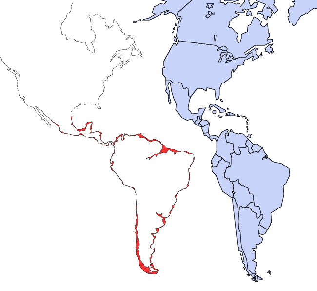
I'm working on mapping the sea level change and the amount of land difference. The blue map to the right is a standard base map that was found by the class. However, it fails to match up with the map I am creating using images from Flood Map pieced together. I'm working on a better way to get the detail I need without tracing around every inch of land. The red shows the difference in a 15 meter sea level rise.

Subscribe to:
Post Comments (Atom)
No comments:
Post a Comment